Blog post – Integrating heritage into climate adaptation strategies: insights from the AGREE Seminar

Dr Mesut Dinler, presenting at the AGREE seminar, held at the Politecnico di Torino, Italy

In recent years, discussions on territorial governance and climate risk management have gained increasing prominence in international policies. The rising frequency of extreme weather events, coastal erosion, hydrogeological (groundwater) instability, and uncontrolled urbanization have made it imperative to rethink planning and management models.

However, cultural heritage – understood not only as a collection of historic buildings but also as a complex urban and landscape system – is often seen as a constraint rather than an asset in making cities more resilient. Risk management and climate adaptation strategies are typically based on infrastructural solutions that overlook the potential of integrating heritage into a broader, more holistic approach.

Yet, research increasingly demonstrates that preserving and reusing historic assets can contribute significantly to sustainability, leveraging traditional materials, construction techniques, and historical knowledge that have already proven their adaptability over time.

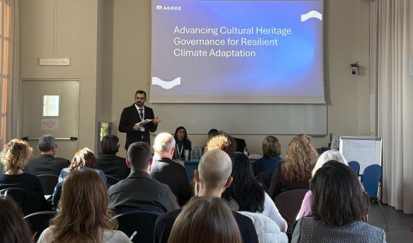
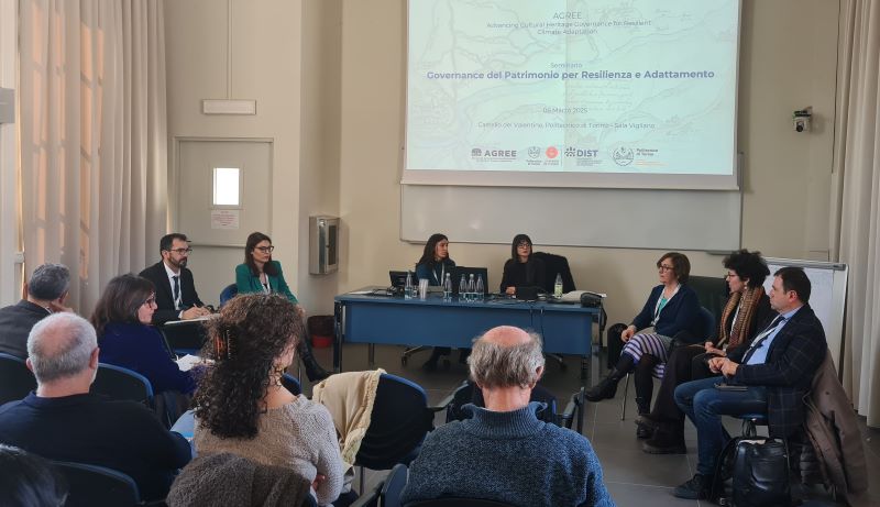
This idea formed the basis of our Governance del Patrimonio per Resilienza e Adattamento seminar, which took place on 6 March 2025, at the Politecnico di Torino, Italy. Organised as part of our international project Advancing Cultural Heritage Governance for Resilient Climate Adaptation (AGREE), the event aimed to foster interdisciplinary dialogue and encourage a more integrated approach to risk management and heritage governance.            

Held within the School of Specialisation in Architectural and Landscape Heritage, the seminar engaged researchers, policymakers, technical experts, and professionals from diverse fields, offering insights and expertise on the topics addressed.

The seminar was structured into three thematic sessions, each exploring different aspects of the relationship between cultural heritage and risk management. The discussions that followed highlighted the need to bridge institutional and disciplinary gaps, fostering a more integrated approach that brings together expertise from urban planning, environmental engineering, heritage conservation, and social sciences.

The first session focused on the role of cultural heritage in mitigating hydrogeological risks and adapting to climate change. Marco Gallo, Regional Minister for Piedmont, opened the discussion by emphasising the importance of an integrated approach to landscape management and existing infrastructure to enhance territorial resilience. Michela Favaro, Deputy Mayor of Turin, followed with an overview of the city’s urban regeneration strategies, highlighting the need for active community involvement in decision-making processes.   

Elena Frugoni and Cristina Lucca, Heritage Officers at the Superintendency of Archaeology, Fine Arts, and Landscape, examined the case of Turin’s riverfront, discussing the challenges of its conservation and the need for more flexible strategies that balance flood management with public accessibility, fostering a stronger connection between historical heritage and urban spaces.             

Gianluca Zanichelli (AIPo – the Interregional Agency for the Po River) explored the role of hydraulic infrastructure in risk prevention, demonstrating how effective planning can significantly reduce the impact of floods and landslides. Paola Mazzoglio, a researcher at the Department of Environment, Land and Infrastructure Engineering (DIATI), Politecnico di Torino, introduced innovative hydrological models for monitoring extreme weather events, stressing the importance of integrating climate data into territorial management policies.

The second session focused on the relationship between historic cities and water resource management. Simona Barbarino (ARPA Piemonte – Regional Environmental Protection Agency) provided an overview of the evolution of meteorological warning systems and their impact on emergency responses, while Professor Daniele Ganora (DIATI, Politecnico di Torino) examined the challenges of pluvial (surface water) flooding in urban areas, discussing strategies to mitigate the effects of sudden heavy rainfall.

The session also featured case studies, including an intervention by Alessandro Trabucco and Claudia Cevrero (Municipal Civil Protection Service and Municipality of Moncalieri), who presented the flood risk mitigation strategies implemented in Moncalieri in response to past flooding events. Their analysis highlighted the effectiveness of preventive measures in reducing hydrogeological risk.     

A notable contribution came from Francesca Paveggio and Daria Guzzinati (World Heritage Porticoes Office, Municipality of Bologna), who explored the challenges of conserving and adapting Bologna’s porticoes, an iconic urban heritage site in a city that often experiences flooding. Their presentation demonstrated how historic structures can actively contribute to urban resilience.

The final session fostered a discussion on governance policies and long-term adaptation strategies. Francesco Tresso, Councilor for the Municipality of Turin, outlined the city’s approach to enhancing urban resilience, emphasising the need for an integrated framework that connects urban planning with risk management. Massimo Bastiani (National River Contracts Board) explored the role of River Contracts as a tool for participatory governance, highlighting the potential of nature-based solutions in mitigating hydrogeological risk.             

Presenters sitting at the front of the room, in front of a room full of seated delegates

In a similar way, drawing examples from European contexts, Mattia Scalas (CMCC– Euro-Mediterranean Center on Climate Change) underscored the importance of climate data and predictive models as key components of effective adaptation planning. Finally, Grazia Brunetta and Angioletta Voghera (Responsible Risk Resilience Centre – R3C, Politecnico di Torino) proposed a new paradigm for territorial resilience, advocating for integrated assessment tools and tailored adaptation strategies that respond to the specific challenges of different urban areas.

The seminar highlighted the need for a fundamental shift in heritage governance and risk management. It became evident that adaptation strategies must incorporate cultural heritage as an active element in resilience planning, rather than treating it as a secondary concern or a constraint to integrated governance.       

The seminar’s findings will be compiled into a summary report, currently being prepared by students from the School of Specialization, including Akila Rose Ferrari and Fausto Finanze, who played an active role in the initiative. This document will serve as a valuable resource for future territorial management policies and a scientific reference for the key themes discussed during the event.    

Looking ahead, the AGREE project will continue developing adaptive governance models that integrate cultural heritage into broader climate adaptation frameworks. The aim is to ensure that historic environments are not only preserved but actively contribute to building more resilient and sustainable territories.


Author: Giulia Bergamo

Dr Giliberto wins Water Woman award

Profile picture of Francesca Giliberto

Dr Francesca Giliberto has been awarded the University of Leeds’ “Water Woman Award 2025” for Early Career Academic.

The Water Woman Awards recognise the achievements of women whose work contributes to the objectives of water@leeds in securing competitive research funds, producing world-class research or achieving significant societal impact. These awards aim to shine a light on their efforts in an academic world in which the hurdles are still greater for women.

This year’s awards coincided with the 10th anniversary of the United Nations International Day of Women and Girls in Science. Now in its fourth iteration, the award is based on two equally weighted criteria: the nature of the achievement plus its potential for empowering and inspiring other women into following their example.

The panel awarded Francesca the Early Career Academic award after being particularly impressed by her funding success and published papers, which were evidenced in the application alongside a clear narrative of the social impact of Francesca’s work.

Francesca said: “My story is a testament to what women can achieve in academia despite ongoing challenges.

“Through mentorship, public engagement and leadership by example, I strive to uplift others and create pathways for the next generation of female researchers, empowering them to pursue ambitious goals, advocate for themselves and foster more inclusive and fulfilling academic environments.

“I’m truly honoured and inspired to receive the Water Woman Award for my achievements as an Early Career Researcher. I firmly believe in the power of resilience, collaboration and advocacy – both in academia and beyond.

“I hope my journey encourages other women to pursue their aspirations with passion, ambition and courage, and to drive meaningful change in their fields and the world around them.”

Blog post – Moncalieri through time: water, landscape, heritage, and resilience

In October 2000, the province of Turin, Italy, endured a severe weather event, suffering through 36 hours of relentless rain. This storm triggered widespread chaos: bridges collapsed, rivers overflowed into towns, major highways were shut down, and rescue teams had to airlift citizens to safety in firefighters’ helicopters.

By the time the rain stopped, the situation was devastating; 10 municipalities and 100 districts were isolated, 15,000 residents were affected, and the cost of the damage was estimated as some billions of euros.

The horror of the disaster was vividly captured throughout the week by La Stampa, a Turin-based major national Italian daily newspaper. A subsequent report from the weekly Il Nostro Tempo, dated 22 October 2000, further highlighted the aftermath: approximately 8,000 individuals were displaced in Piedmont, numerous roads and railways disrupted, and between 80,000 to 90,000 people left without electricity.

Given the scale of this damage caused by heavy rains, one cannot help but ask ‘why?’  Why did such heavy rains cause catastrophic damage, especially given the region’s lengthy experience with similar weather conditions?

Screenshots from the recordings of the Moncalieri floodings during October 2000

Figure 1: Screenshots from the recordings during the October 2000 flooding. The footage is taken from the DVD “Eventi alluvionali in Piemonte 2000-2002” by Arpa Piemonte (Regional Agency for Environmental Protection), produced by Fabula, from the “Video Archive” section, which includes recordings from November 2–6, 1994; October 13–16, 2000; and June 4–6, 2002. Courtesy of the ARPA Piemonte. Licensed with Creative Commons Attribution license. A portion of the footage is also available on the YouTube page of the Consiglio Regionale del Piemonte (Piedmont Regional Council).

In our Advancing Cultural Heritage Governance for Resilient Climate Adaptation (AGREE) project, one of our goals is to explore new governance models for cultural heritage that support climate adaptation and enhance community resilience in urban contexts at risk of flooding. Investigating past disasters is an integral part of this endeavor. Asking ‘why did it happen this way in the past?’ is crucial.

Without understanding the past, we risk repeating the same mistakes. However, the AGREE project recognises that for effective climate adaptation and community resilience, learning from the past must be integrated with future-oriented, scenario-based thinking due to the uncertainties that lie ahead. To this end, while we work with existing international datasets, we also gather local data from our case studies to identify future trends and scenarios. This baseline is augmented with experiences from past disasters. In doing so, we aim to incorporate memory as a component of future policies and decision-making processes.

Moncalieri, located along the Po River, crossed by Sangone and Chisola streams, below the hills of Turin and administratively under the metropolitan city of Turin, is one of AGREE’s three case studies, exemplifying the unique challenges and opportunities in managing urban heritage within flood-prone areas. (You can read about the UK case study here, and the Norway case study here.)

With its rich heritage, intricate relationship with the Po River, and history marked by floodings, Moncalieri provides critical insights into how cultural heritage can help us navigate through the complexities of climate adaptation and community resilience.

19th centure painting of the Moncalieri Castle and its village from the Po river

Figure 2: View of the Moncalieri Castle and its village from the Po river. The painting, probably made by Luigi Baldassarre Reviglio in the first half of the 19th century, was commissioned by the Marquises of San Germano, from the Sanmartino family. [Catalogo generale dei Beni Culturali. – Private Collection. Digital reuse is licenced with CC-BY 4.0. https://catalogo.beniculturali.it/detail/HistoricOrArtisticProperty/0100441131 ]

A history of water: urban heritage of Moncalieri

Moncalieri is a multi-layered town that embodies centuries of urban transformation within its current urban fabric. From its medieval castle, a UNESCO World Heritage Site, to its agricultural lands, and from its historical centre to the traces of a working-class history intertwined with nineteenth-century industrialization, Moncalieri exemplifies the complex relationship between water, urban heritage, flooding disasters, and urban development.

Buildings on the hillside in Moncalieri

Moncalieri in November 2024. Photo by Giulia Bergamo.

Moncalieri historic centre

Moncalieri historic centre in November 2024. Photo by Giulia Bergamo.

Moncalieri’s geopolitically strategic position played a crucial role in becoming one of the main administrative centres of the savoy dynasty, controlling the principal routes between Turin, southern Piedmont, and the surrounding regions. It also dominates the Po and Chisola Rivers, which were vitally important not only as resources for economic activities but also as military defence infrastructures along with the hills of Turin. In medieval times, the mills along the Po and Chisola rivers were economic assets that supported agricultural production, although primarily utilized by nobles and religious institutions. The need for defense was met by constructing Moncalieri Castle, which over time became a royal residence.

As Moncalieri evolved into a complex urban settlement over the centuries, water resources continued to play a crucial role in the everyday lives of artisans and in agricultural activities. The city gradually developed religious, civil, and road infrastructures that enhanced communications and commercial activities. Meanwhile, the Savoy Castle and the ‘Porta Molendinorum’, an ancient urban gate, continued to regulate the passage and control of mill-related commercial and production activities. The religious infrastructures – new monasteries and churches, along with the road network connecting them – played a role in Moncalieri’s development during the 17th and 18th centuries, a period of urban expansion and economic consolidation.

With nineteenth-century industrialisation, Moncalieri’s urban character began to change, though the importance of the river system remained undiminished; the Po was still essential for survival. While the historic urban centre preserved its significance, the city transformed into a residential area for Turin’s bourgeoisie. Immigrant working-class residents and families occupied the outskirts of the city; while Turin’s bourgeoisie began constructing villas and residences, turning Moncalieri into a privileged appendage to the Savoy capital.

The 20th century was marked by a profound transformation of the territory, with demographic growth and the establishment of new residential and industrial districts. However, this intense development did not erase the historical identity of Moncalieri, which still preserves its architectural and landscape heritage. The connection with water and the territory remains a crucial interpretive key to understanding Moncalieri’s urban development over the centuries.

An interlinked history of Moncalieri with floodings

While the water resources had this important role in the urban development of the city, they have also posed significant threats to Moncalieri. The Po River had a strong impact not only over the territory and infrastructures, but also on the Moncalieri community. Its geographical location, together with a fast and sometimes unplanned urbanization, has made the territory more exposed to the effects of heavy rains and river flooding.

In fact, even today, despite several individual planning instruments and future strategies, there are no appropriate planning implementations that integrate sustainable urban development mechanisms addressing hydrogeological hazards. Moreover, throughout Moncalieri’s history, riverbeds have been reduced and the original hydrographic network has been modified, which contributed to the severity of disasters.

One of the first major disasters of the 20th century occurred in 1949, when the Po overflowed following torrential rains. Moncalieri was particularly affected by the waters of the Po, Chisone and Sangone that flooded the countryside and part of the city. The following flood of 1977 reinforced awareness of the need for better land management and the protection of vulnerable areas.

Two of the most infamous disasters are those of November 1994 and October 2000. The first left a deep mark in the collective memory, not only of Moncalieri, but also of large part of Piedmont. It is still a trauma in many individuals’ personal history in Piedmont. Only six years later, in 2000, the city was hit again, particularly because of its location at the confluence of the Po and Sangone rivers. This 2000 disaster caused a lot of damage to the city’s districts, including Vallere and Borgo Mercato. More recent history, however, includes the 2016 flood, which further highlighted the exposure and vulnerability of the area.

Integrating historical data with narratives on memory for future decision-making

As mentioned at the start of this blog post, one of the main ambitions of AGREE is to introduce the ‘memory of past disasters’ as an input into decision-making processes and governance mechanisms. Achieving this ambition requires working with local, national, and international data to understand the components of disaster risks that threaten the territory.

For the case of Moncalieri, existing data categorises the territory into three risk zones for fluvial (e.g. river or stream) risks. Furthermore, it is possible to trace changes in land use through publicly available international datasets. Additionally, data is also available for understanding listed buildings and protection areas in relation to heritage.

However, when it comes to memory, it would be unrealistic to suggest that any historical or current data could fully capture it. In his famous essay Les Lieux de Mémoire, Pierre Nora argued that memory is a living, evolving phenomenon, shaped by society, emotion, and context, while history is a problematic and incomplete reconstruction of the past.

Building on Nora’s point, AGREE goes a step further to understand and provide narratives of memory constructed through deep, archival local research – not merely to extract data but to uncover stories that complement existing datasets.

In this way, we aim to provide a deeper understanding and insights into the intricate relationship between cultural heritage, climate adaptation, and community resilience. One of the final outcomes of this research will be to create a digital platform designed to communicate these insights and understandings to a diverse network of users. By doing so, as outlined in previous blog posts, the AGREE project remains committed to advancing this relationship within the scope of cultural heritage governance.


Authors: Dr Mesut Dinler, Giulia Bergamo and Alice Bisso

Blog post – Flooding in Lillehammer: integrating cultural heritage into disaster risk management

The Advancing Cultural Heritage Governance for Resilient Climate Adaptation (AGREE) project focuses on integrating cultural heritage into disaster risk management strategies, particularly in flood-prone regions. Climate change intensifies natural and socio-economic impacts globally, leading to more severe weather events, such as floods, that threaten lives, infrastructure, and heritage sites.

The Intergovernmental Panel on Climate Change (IPCC) defines climate risks as the result of interactions between human and ecological systems’ climate-related hazards, exposure, and vulnerability. Urban cultural heritage can be better protected by enhancing disaster risk management strategies that account for its unique and complex vulnerabilities.

Lillehammer, situated along the river Mesna in Norway’s Gudbrandsdal Valley, represents an ideal case study for AGREE, given its historical and cultural value and exposure to flooding. This post will illustrate Lillehammer’s history and cultural heritage, as well as its challenges and opportunities in evolving risk management practices and adaptation strategies.

Flooding in Norway (taken from Infotiles):

  • Floods are mainly due to snowmelt and extreme rain
  • Spring is the high season for floods in eastern Norway
  • It will cost 85 billion Norwegian Kroners (NOK) to secure buildings against floods and landslides
  • 210,000 buildings in Norway need protection against floods and landslides, according to the Norwegian Water Resources and Energy Directorate.
  • In the last 10 years, damage caused by weather and natural events has cost 27 billion NOK in Norway. Some of this damage could be prevented with a warning system and swift action from the municipalities.

Lillehammer: A historical overview

Located at the northern end of Lake Mjøsa, Lillehammer has been a hub for trade and settlement since its early days. The town achieved city status in 1842, shaped by industrial expansion and strategic positioning along major transportation routes. The river Mesna has historically been central to Lillehammer’s development, supporting trade, transport, and hydropower generation. Lillehammer was founded according to the principles of urban planning in the 19th century, following classical European design, with a grid layout and orderly streets. This planned approach emphasised aesthetics, symmetry, and functionality, with each structure designed to reflect the city’s cultural and architectural heritage.

Urban development in Lillehammer exemplifies the early practices of modern urban governance, where city planning was understood as both a technical and legal endeavor. In the 1800s, the prevailing mindset viewed natural landscapes as manageable and incorporated them into the city’s layout. This approach resulted in a distinctive combination of urban and natural elements, creating an ordered cityscape where buildings and streets harmonized with the surrounding landscape. Indeed, these qualities, closely linked to Lillehammer’s mountain landscape, contributed to the city hosting the 1994 winter Olympics.

Lillehammer’s relationship with the Mesna River

The river Mesna, flowing through Lillehammer from the east, has played a defining role in the city’s history and continues to influence its urban landscape. Over the years, different views on the river’s value and purpose have emerged. Initially, Mesna served as a critical resource for hydropower and transportation, supporting industries like logging and milling. In the early 20th century, log driving on the Mesna facilitated timber movement, reinforcing the river’s industrial importance.

However, by the late 19th century, attitudes towards nature conservation gained traction, with the river’s waterfalls attracting tourists and inspiring artists. As Norway’s national focus shifted toward environmentalism, the river began to take on recreational and aesthetic roles. Today, the Mesna is a popular site for leisure activities, with locals and tourists enjoying its scenic beauty from walking paths, parks, and riverside cafes. This evolving relationship with the river reflects broader changes in society’s values and priorities.

Dr Paloma Guzman stood smiling by the Mesna river which runs through the center of Lillehammer.
Dr Paloma Guzman surveys the Mesna river which runs through the center of Lillehammer. The river has played an important role in the industry of the city. (Photo credit: Ole Fredrik Unhammer)

Dr Paloma Guzman surveys the Mesna river which runs through the center of Lillehammer. The river has played an important role in the industry of the city. Photo credit: Ole Fredrik Unhammer

Cultural heritage and flood risks in Lillehammer

Lillehammer’s rich cultural heritage and the increasing frequency of extreme weather events pose unique challenges. Floods in Norway are primarily driven by snowmelt and heavy rainfall, and climate change is expected to intensify these occurrences. Notable floods in Lillehammer, such as the “Storfosen” of 1789 and Vesleofsen in 1995, have caused significant damage, particularly from debris, such as timber washed away from sawmills upstream. As floods disrupt daily life and damage property, they threaten the preservation of heritage sites, which hold cultural and historical significance for the community.

Flood risk management in Norway has traditionally relied on physical interventions, such as levees and stone riprap, to protect vulnerable areas. However, there is a growing recognition that traditional infrastructure alone is insufficient to address the complex challenges of climate change. For instance, flood control measures in Lillehammer have expanded beyond physical barriers to include predictive systems and adaptive planning, which aim to mitigate risk while respecting the town’s historic character.

Integrating heritage into disaster preparedness: Lillehammer’s approach

Recognising the importance of cultural heritage in fostering social identity and resilience, Norwegian authorities are exploring ways to integrate heritage preservation into broader risk management frameworks. In collaboration with local and national authorities, the AGREE project has participated in testing a national pilot project for the risk and vulnerability analyses specific to cultural heritage sites. These assessments, known as ROS analyses (risiko og sårbarhetsanalyser), help identify potential hazards and vulnerabilities that could impact heritage sites during natural disasters.

A recent example of these efforts followed the extreme weather event “Hans,” which caused severe flooding and landslides, highlighting the need for robust preparedness plans. Such initiatives prioritise protecting cultural assets while enhancing the municipality’s readiness to respond to future climate-related events.

AGREE’s view on Historic Urban Landscape (HUL) approaches can be a valuable framework for municipalities to incorporate cultural heritage into their disaster planning. Our starting point is that this challenge requires fundamental and paradigmatical changes in managing urban cultural heritage. These should involve climate policies that address lifestyles and society in a broad way so that HUL conservation can create sustainable changes.

The IPCC defines transformation in the context of climate change adaptation as “the altering of fundamental attributes of a system (including value systems; regulatory, legislative, or bureaucratic regimes; financial institutions; and technological or biological systems)”. Thus, cultural heritage management is increasingly linked to biodiversity protection, just energy transitions, urban equity, and inclusive development.

Evolving urban governance and flood preparedness in Lillehammer

Modern urban planning in Lillehammer reflects a balance between development and preservation, integrating flood risk management into the city’s governance framework. Historical urban development in Lillehammer imposed a structured grid layout over the natural landscape, characterised by rich water streams. This practice was typical of the 19th century, aiming to control and organise the environment. This approach has gradually shifted as contemporary urban governance increasingly considers natural dynamics and climate impacts in planning decisions.

Today, Lillehammer’s approach to urban governance involves integrating natural landscape elements, like the Mesna River, into urban planning decisions that respect heritage values while addressing modern-day environmental challenges. The river Mesna, once a symbol of industrial power, has transitioned into a valued recreational and ecological asset. This change has led to the development of public spaces along the river, encouraging interaction between the town’s residents and its natural surroundings. These evolving practices underscore the role of urban governance in mediating human-nature interactions within a cultural landscape.

Future directions: a preparedness plan for cultural heritage

As part of the AGREE project’s objectives, the Norwegian Institute for Cultural Heritage Research (NIKU) participated in a pilot project led by the Norwegian Directorate of Cultural Heritage to strengthen municipalities’ heritage protection through a comprehensive preparedness plan that accounts for several risks, including environmental hazards. The project is working on refining guidelines that will provide municipalities with a unified methodology for conducting these analyses, integrating heritage protection into broader social security frameworks.

Workshop participants at an an on-site assessment of the wooden house environment in Storgata. In the picture we see the participants being presented with the implemented measures at goldsmith J. Frisenberg. (Photo credit: Ole Fredrik Unhammer).
The Risk and Vulnerability Analysis workshop included an on-site assessment of the wooden house environment in Storgata. In the picture we see the participants being presented with the implemented measures at goldsmith J. Frisenberg. (Photo credit: Ole Fredrik Unhammer).

The Risk and Vulnerability Analysis workshop participants attended an on-site assessment of the wooden house environment in Storgata. Photo credit: Ole Fredrik Unhammer

Working with practitioners and authorities, NIKU aims to contribute to the shift in Norway’s approach to disaster preparedness, placing cultural heritage alongside other critical governance areas of concern, such as infrastructure and public health. AGREE’s research efforts could have a significant transfer potential for many European regions, where heritage sites face heightened flooding risks. The forthcoming preparedness plan will be valuable for local governments, helping them safeguard heritage sites while addressing contemporary climate challenges.

Lillehammer’s legacy and resilience

Lillehammer’s experience illustrates how urban planning and heritage management approaches must transform and adapt to changing environmental conditions while preserving cultural identity. Integrating heritage into flood risk management reflects a broader trend in urban governance, where cultural assets are increasingly recognised as essential components of community resilience.

In this way, the AGREE project’s case study on Lillehammer illuminates the transformative role of cultural heritage in fostering resilience, offering valuable insights for other communities facing similar climate risks. AGREE aims to support collaborative efforts and forward-looking policies in Lillehammer as a town that respects its history while preparing for an uncertain future.

Read our previous blog post to find out more about our UK case study – Hull.


Authors: Dr Paloma Guzman and Ole Fredrik Unhammer

Blog post – Living with water: heritage, flooding and resilience in Hull

As climate change continues to present significant challenges to our governance systems, innovative and integrated solutions are essential for building community resilience and effective climate adaptation.

Our project, Advancing Cultural Heritage Governance for Resilient Climate Adaptation (AGREE), focuses on collaborative strategies across Europe to enhance our understanding and management of cultural heritage amidst climate change and flood risk. In this post, I  introduce the first of our three project case studies, highlighting the unique context of Kingston upon Hull (often referred to as “Hull”). We will explore the city’s challenges and opportunities for adaptive governance in response to these pressing issues.

Understanding Hull: A city shaped by water and heritage

Hull, situated in East Yorkshire, England, is a city rich in cultural heritage and history, yet it faces significant climate-related challenges, particularly flooding and coastal erosion. As a low-lying area, with approximately 90% of the city below sea level at high tide, Hull ranks as the UK’s second most vulnerable city to flooding, after London.

Aerial view of Hull and the waterside

Designated as the UK City of Culture in 2017, Hull is one of the country’s major port cities, known for its trading links with Europe and its heritage sites, which encompass maritime history, architectural landmarks, and urban landscapes. Hull is also celebrated as the birthplace of William Wilberforce, with Wilberforce House serving as a poignant reminder of the historical fight against slavery, both past and present. Additionally, Beverley Gate, located in the city centre, marks the site where Charles I was denied entry, an act widely recognised as a catalyst for the English Civil War. This rich tapestry of history is reflected in the diverse array of historic buildings and structures found throughout the city, particularly in the Old Town.

For over 800 years, Hull has fostered a distinctive connection with its waterways, including the River Hull and the Humber Estuary. Originally established as a trading port for exporting lead, grain, and wool during the medieval era, Hull transitioned from the ownership of the monks of Meaux Abbey to King Edward I of England in 1293, who renamed it Kingston upon Hull. By the end of the 18th century, Hull had become the largest whaling port in the country and developed into a major fishing centre by the late 19th century. The town remained confined within its medieval boundaries until the late 18th century, when it began to expand rapidly.

Today, Hull, with its 20th-century waterfront docks, sits at the heart of the Humber Port complex, the largest in the UK, and is also home to one of Europe’s largest wind turbine manufacturing plants. This development underscores Hull’s ambition to become a leading national centre for the offshore renewables sector, highlighting its commitment to innovation and sustainability in the face of climate challenges.

Throughout its history, Hull has encountered significant flooding events that have driven innovative solutions and adaptations to manage this persistent threat. The city’s relationship with water has been marked by destructive floods that have influenced its development. As early as the 1700s, windmills were constructed to pump water away from low-lying areas, and by 1980, the River Hull Tidal Surge Barrier was built to protect against tidal surges.

However, despite these efforts, Hull has faced considerable challenges. The long-duration rainfall event in November 2000 saturated the ground and flooded low-lying areas, while the intense rainfall in June 2007 overwhelmed the city’s drainage systems. The tidal surge of December 2013 posed unprecedented challenges, with record water levels causing significant flooding in Hull and its surroundings, including more than 400 properties and main roads.

The floods of 2007 were particularly devastating, marking a turning point in Hull’s relationship with water. During those tumultuous weeks, the city experienced its wettest May to July on record since 1776, leading to approximately 7,800 homes flooded and 1,300 businesses affected, with repair costs estimated at a staggering £200 million. Such incidents serve as blunt reminders of the challenges Hull faces as it strives to safeguard its future.

In this context, the implications of climate change are profound and multifaceted. The global climate is shifting, leading to long-term changes in average weather conditions, including higher temperatures, altered precipitation patterns, and rising sea levels. Hull faces wetter winters, drier summers, and more frequent occurrences of intense rainfall. These changes increase the likelihood of flash flooding as drainage systems become overwhelmed, which is particularly concerning given that existing sewage systems infrastructure is already operating at capacity.

Responding to flooding and climate change

Hull serves as an exemplary case study, offering valuable insights into historical responses to recurrent flooding across various eras. Understanding the city’s specific needs and developing tailored strategies are essential for preserving its cultural identity while ensuring resilience.

Hull illustrates how local communities navigate flooding challenges within their cultural, geographical, historical, and policy contexts. This comprehensive perspective emphasises the adaptive responses and innovative policies necessary for addressing environmental hazards and enhancing societal resilience in waterfront areas.

However, whilst navigating these complexities, Hull faces a challenging financial landscape. With reduced budgets and funding cuts increasingly common, managing flood risk has become more daunting than ever. The need for collaboration across policy sectors  at different scales has never been more critical.

One of the most perplexing challenges in flood risk management in the UK is the multitude of authorities involved. While each plays a role, the lack of clarity regarding responsibilities can lead to confusion. It is essential to recognise that no single authority has a legal obligation to prevent flooding; in many cases, completely halting floods is simply not feasible, as nature often follows its own course. Instead, Risk Management Authorities (RMAs) are tasked with assessing risks and implementing mitigation strategies wherever possible.

Hull’s flood risk management strategy 2022-2028 reflects this reality by thoroughly examining the various flood risks that threaten the community. Drawing from lessons learned from past events, the city’s approach is informed by both historical precedents and urgent needs. It is not just about recovering from past disasters; it is also about preparing for the future. Like many coastal cities, Hull must look ahead to future generations, developing strategies that not only protect its heritage but also foster resilience in an uncertain climate.

A key initiative aimed at building resilience is the Living with Water partnership, which envisions a thriving city that embraces its relationship with water. Over the past six years, more than £220 million has been invested in flood infrastructure to mitigate the risk of flooding to homes and businesses in Hull, achieved through collaborative efforts with other risk management authorities.

As flood risk is anticipated to worsen with climate change, the focus over the next six years will be on enhancing resilience and preparedness. This will involve integrating nature-based solutions alongside engineered flood infrastructure, promoting a holistic approach to managing local flood risk while addressing the environmental challenges associated with climate change.

The role of cultural heritage

As Hull evolves, it is critical to ensure that its distinctiveness is preserved amidst these changes. This includes recognising the maritime role that has shaped its identity and the significance of historic buildings, all while adapting to the realities posed by climate change.

But what is the role of cultural heritage in the context of climate change and flooding? This is precisely what we aim to explore through our AGREE project. How have cultural heritage and community resilience been influenced over time by various flooding experiences? In what ways have these historical flooding events impacted local policies? Moreover, how can we foster a stronger integration of cultural heritage, climate change, and flood disaster risk management policies to bolster both heritage and community resilience in the face of a changing climate?

These are some of the key questions we seek to address in our work. Hull City Council, alongside representatives from the climate change and disaster risk management offices, is a partner in our project. Their involvement will help facilitate collaborations with local stakeholders, access valuable local databases—including Geographic Information Systems (GIS) and historical archives—and maximise our impact.

On a national level, the UK’s Department for Culture, Media and Sport (DCMS) is also a research partner. They will support us in connecting with and learning from various national policymakers at DCMS, the Department for Environment, Food & Rural Affairs (DEFRA), and the Department for Energy Security & Net Zero (DESNZ). These partnerships represent a significant opportunity to bridge cultural heritage governance with broader national, regional, and local climate adaptation strategies.

Next steps

The Hull case study exemplifies the AGREE project’s commitment to advancing cultural heritage governance in the context of climate adaptation. While the research team actively collects and analyses current policies across various sectors, we are also focused on fostering new collaborations and synergies with local stakeholders.

As the project leader, I have been invited to present our work and discuss potential synergies with the Yorkshire and Humber Climate Commission (YHCC). This independent advisory body aims to unite public, private, and third-sector actors to support ambitious climate actions across the region. I look forward to gathering feedback and exploring collaborative opportunities with a broader range of local authorities participating in the Climate Adaptation Programme for Local Authorities (CAPLA).

By fostering these connections, we aim to deepen our understanding of the unique challenges facing Hull and develop adaptive strategies that not only protect our cultural heritage but also enhance community resilience in the face of climate change.

Are you curious about our other project case studies? We will shortly publish other posts on the Research and Innovation Blog featuring our case studies from Lillehammer in Norway, and Moncalieri (Turin) in Italy. You can also visit our project website to keep up-to-date with our project activities and join the AGREE LinkedIn group.


Author: Dr Francesca Giliberto

Dr Giliberto features on Business Daily

Dr Francesca Giliberto recently contributed to an episode of Business Daily, sharing her expertise on the evolving concept of cultural heritage.

The episode – “The Cost of Preserving Our Heritage” – hosted on the BBC World Service, explored how developers in the Global North are legally obligated to fund archaeological work before construction, while heritage preservation in the Global South often depends on tourism. The episode delved into the challenges of over-tourism at World Heritage sites, questioning whether the UNESCO World Heritage List is inadvertently causing harm to the very locations it seeks to protect.

Dr Francesca Giliberto played a key role in the episode by discussing the evolving concept of cultural heritage. She emphasised how Western countries traditionally define heritage in terms of monuments and architecture, while in other parts of the world, heritage is often a seamless blend of culture and nature.

Dr Giliberto highlighted the importance of “cultural landscapes,” where human activity and natural environments are interlinked. As an example, she pointed to the rice terraces in the Philippines, which represent a dynamic, living landscape that continues to be shaped by the local community. This approach to heritage preservation, according to Giliberto, offers a more sustainable model, focused on maintaining traditional practices rather than relying solely on tourism for survival.

Listen to the episode here.

 3-line wavy pattern

Blog post – Advancing cultural heritage governance for climate change adaptation

Flooded river coming up to the doors of houses and businesses in York
River Ouse, York, UK

Despite global commitments like the Paris Agreement and the United Nations’ Sustainable Development Goals (SDGs), progress towards necessary climate action has been inadequate in terms of speed, scale, and depth.  

Climate change poses a significant challenge that intersects with social, economic, and environmental factors. However, traditional approaches to sustainability often fall short due to their narrow focus on technical solutions. This limited perspective inhibits the development of comprehensive, context-specific strategies. 

In response, our new project – Advancing Cultural Heritage Governance for Resilient Climate Adaption (AGREE) – advocates for a transformative approach to sustainability, emphasising interdisciplinary collaboration and societal shifts. We plan on exploring the intricate relationship between cultural heritage governance, climate adaptation, and community resilience, particularly in urban areas vulnerable to flooding. 

Cultural heritage governance and the need for systemic change 

According to UNESCO, heritage is “our legacy from the past, what we live with today, and what we pass on to future generations.” As such, the concept of heritage is a dynamic and evolving entity, intricately connected to individuals, communities and places, bridging past, present and future. It encompasses tangible elements such as monuments, historic buildings, sculptures and paintings, but also intangible aspects like social practices, traditions and values, collectively form this legacy.  

The sustainable preservation of both cultural and natural heritage is included in SDG11 – “sustainable cities and communities”.  

Currently, a more integral consideration of cultural heritage and its role in climate adaptation is held back by a strong ideology and organisational structure that opposes development and change. Commonly, climate change is seen as a threat to cultural heritage material and intangible attributes. This vision perpetuates reactive rather than proactive management practices.  

The Historic Urban Landscape approach 

We will be focusing on the systemic relationship between cultural heritage governance, climate adaptation, and community resilience, and in doing so, we will advance the UNESCO Historic Urban Landscape (HUL) approach. HUL is a landscape-based approach to urban heritage management that goes beyond traditional preservation efforts, integrating environmental, economic, and social sustainability.  

It recognises that a city’s cultural and natural significance is not just found in individual buildings or sites, but also in the overall urban fabric and its surroundings, including the intangible relationships between buildings, urban spaces, and the people who inhabit them. 

The HUL approach aims to ensure that heritage preservation contributes to the vitality and resilience of urban communities in the face of current pressures such as climate change. 

We will produce an innovative HUL-based decision-making model to visualize past and new urban and climate interdependencies, comparing current national and local policy discourses in different countries with historical data sources that reveal lessons in urban resilience reflected in local strategies and changes in the built environment over time.  

Exploring responses to flooding 

We will be using three case studies – Hull (UK), Lillehammer (Norway), and the Po riverside in Turin (Italy) – to explore responses to flooding in three urban contexts. These case studies will be used to analyse the intricate link between cultural heritage governance, climate adaptation and community resilience.  

These three areas have been chosen as they represent diverse historic urban landscapes confronting flooding challenges in coastal, lake, and river settings. They provide unique insights into how local communities navigate flooding challenges within their cultural, geographical, and historical contexts, offering a comprehensive view of adaptive responses and innovative policies for environmental hazards and societal resilience in waterfront contexts.  

Hull, UK City of Culture in 2017, is the UK’s second most vulnerable city to flooding, after London, primarily due to its low-lying position at the confluence of two rivers—the Hull and the Humber—and its proximity to the North Sea. With an 800-year history of managing water risks and several major floods documented in the city and regional archives, Hull provides an exemplary case study for understanding historical responses to recurrent flooding across different eras.  

Lillehammer, renowned for landscapes and historical significance, was tested during recent catastrophic events like Storm Hans, showcasing local governance capacity for climate adaptation and risk management.  

The Po riverside in Turin holds deep historical and cultural significance, marked by a legacy of wrestling with the Po River’s dual identity as both a crucial life source and a formidable threat, prominently underscored by the alternating challenges posed by the river flooding and periods of drought. 

Next steps 

We will be discussing our project’s strategies to address the challenges outlined above at the “Nature-Culture Relations” panel during the Sustainability Research and Innovation Congress (SRI) in June 2024 in Helsinki. This discussion is part of the Climate Cultural Heritage (CCH) 2023 kick-off meeting, organised by the Belmont Forum. 


Author: Dr Francesca Giliberto